
Utrecht stories · History
The Road That Became Water Again
How Utrecht replaced part of its medieval moat with a four-lane road—and spent decades bringing the water back.
1122–1830
Documented fact
A moat makes a city
Catharijnesingel, Utrecht · 52.089, 5.105
The story begins with a legal change and a physical one. Utrecht received city rights in 1122. Soon afterwards, residents began digging a defensive moat around the settlement. The earth taken from it was used to raise a rampart; walls and towers of volcanic tuff were built on parts of that bank.
The singel was therefore more than a line of water. Together with the wall, gates and towers, it marked where the protected city ended. A municipal heritage account says those defences were tested in 1345, when Count Willem IV of Holland besieged Utrecht for six weeks with an army it estimates at about 30,000 men. The number should be read as a historical estimate, but the episode makes the original purpose of the water clear: it was part of a working defence system.
That purpose did not last forever. By the nineteenth century, the walls no longer served the military role for which they had been built. Their demolition began in 1830 under a plan associated with landscape architect Jan David Zocher Jr. The crucial choice was what did not disappear. The singel remained, still carrying water around the city.
Utrecht had begun to reinterpret its edge. A medieval fortification could outlive the structure it had defended.
Evidence and sources (2)
- De Utrechtse stadsverdediging
Documents Utrecht's city rights, defensive moat, fortifications, siege account, and the nineteenth-century transition.
Gemeente Utrecht — Erfgoed Utrecht · Accessed - Een singel rondom
Documents Utrecht's city rights, defensive moat, fortifications, siege account, and the nineteenth-century transition.
Gemeente Utrecht — Erfgoed Utrecht · Accessed
- De Utrechtse stadsverdediging
1811–1931
Documented fact
From working water to green promenade
Catharijnesingel, Utrecht · 52.089, 5.105
The singel did not have just one life after the walls became obsolete. Water, road and greenery developed beside one another, each serving a different version of the city.
Until the end of the nineteenth century, the Catharijnesingel formed part of the Keulse vaart, an important water connection between Amsterdam and Cologne. The route had to accommodate changing ships: in 1854, part of bastion Sterrenburg was removed to make room for larger vessels. When the Merwedekanaal opened in 1892, traffic through the old singel route largely fell away.
The land beside the water was already part of a wider transport network. In 1811, the road along the Catharijnesingel became part of Route Impériale 2, the imperial route between Amsterdam and Paris. The canal and the road were neighbours long before one replaced the other.
Zocher’s nineteenth-century park plan introduced another use. Trees and paths helped turn the former defensive zone into a green promenade. A municipal heritage account records 1,317 trees between Catharijnebrug and Ledig Erf in 1830. Almost all were later felled or replaced when the road was widened and asphalted in 1931.
That episode anticipated the argument that would define the next decades. Space along the singel was limited. Every new priority—shipping, walking, planting, driving—changed what could remain beside it.
Evidence and sources (2)
- Catharijnesingel
Documents the singel's uses as water route, roadside corridor, and green promenade.
Gemeente Utrecht — Erfgoed Utrecht · Accessed - De Utrechtse stadsverdediging
Documents the singel's uses as water route, roadside corridor, and green promenade.
Gemeente Utrecht — Erfgoed Utrecht · Accessed
- Catharijnesingel
1958–1960
Documented fact
The city chooses the car
Catharijnesingel, Utrecht · 52.089, 5.105
By the late 1950s, the pressure came from motor traffic. Cars were increasingly treated as a central planning problem, and Utrecht considered remaking its old boundary on a much larger scale.
In 1958, the municipal executive—the College of Mayor and Aldermen—accepted a plan that would fill the entire Stadsbuitengracht. In its place would come an inner ring road, parking garages and twelve radial roads leading into the city. This was not yet an adopted council plan. The municipal council rejected it and asked for an urban plan before a traffic plan.
That distinction matters. The familiar summary that Utrecht simply approved a complete motorway around the centre turns a contested planning process into a single decision. The archival record described by Oud-Utrecht shows proposals moving between the executive, council and outside planners, with approval at one level and resistance at another.
In 1960, Rotterdam planner J. A. Kuiper was asked to produce an alternative. His tangent-road proposal also met opposition and was not approved by the municipality. Yet the underlying problem remained unresolved: how should expanding car traffic reach the centre and the station area?
The singel survived these first plans, but it had been recast in official thinking. Water that had once protected and connected Utrecht was now also considered space that traffic infrastructure might occupy.
Evidence and sources (1)
- De Amsterdamsestraatweg in Utrecht: Van belangrijke winkelstraat tot afvalputje
Documents the 1958 executive decision, council rejection, and the unapproved 1960 alternative.
Oud-Utrecht · Accessed
- De Amsterdamsestraatweg in Utrecht: Van belangrijke winkelstraat tot afvalputje
1964–1970
Documented fact
Water becomes road
Catharijnesingel, Utrecht · 52.089, 5.105
The eventual loss of water was tied to the redevelopment of Utrecht’s station district. Hoog Catharijne promised a new commercial centre beside the railway, but it also brought a demand for car access on a scale the old streets were not designed to handle.
On 15 May 1964, Utrecht’s council decided to fill the Weerdsingel and Wittenvrouwensingel in connection with its obligation to provide access to the Hoog Catharijne project. The works that followed did not reproduce that decision in a simple or complete way. National heritage protection changed what the city could do.
In June 1965, the singels and bulwarks received national-monument status in an intervention associated with culture minister Marga Klompé. It is tempting to cast one minister as the person who saved the entire ring, but the evidence supports a more careful account: heritage protection became a powerful constraint within a longer negotiation involving national government and the municipality.
In January 1968, the national government allowed partial filling. A scholarly account says that Utrecht would abandon further road breakthroughs through the inner city in exchange. The precise legal terms still require inspection of the original government and municipal files, so the agreement should not be reduced to a claim about one contract or one financial penalty.
The result was nevertheless concrete. The northern Catharijnesingel became the sunken Catharijnebaan. A later municipal audit describes it as a four-lane road. The western Weerdsingel, as far as Bemuurde Weerd, became parking space. Gemeente Utrecht’s heritage service summarizes the partial filling as taking place in 1970, connected to car access for Hoog Catharijne.
This was not the total disappearance proposed in 1958. It was a compromise, but one that still removed a substantial section of water and redrew the western edge of the old centre.
Evidence and sources (5)
- De Amsterdamsestraatweg in Utrecht: Van belangrijke winkelstraat tot afvalputje
Documents the Hoog Catharijne access decisions, heritage intervention, partial filling, and realised road.
Oud-Utrecht · Accessed - Project Stationsgebied: Informatievoorziening aan de gemeenteraad van Utrecht
Documents the Hoog Catharijne access decisions, heritage intervention, partial filling, and realised road.
Rekenkamer Utrecht · Accessed - Een singel rondom
Documents the Hoog Catharijne access decisions, heritage intervention, partial filling, and realised road.
Gemeente Utrecht — Erfgoed Utrecht · Accessed - Catharijnesingel
Documents the Hoog Catharijne access decisions, heritage intervention, partial filling, and realised road.
Gemeente Utrecht — Erfgoed Utrecht · Accessed - Bergstraat — Basisrapportage Archeologie 71
Documents the Hoog Catharijne access decisions, heritage intervention, partial filling, and realised road.
Gemeente Utrecht · Accessed
- De Amsterdamsestraatweg in Utrecht: Van belangrijke winkelstraat tot afvalputje
1970–2004
Interpretation
Changing the plan
Catharijnesingel, Utrecht · 52.089, 5.105
Even as part of the singel became road, the larger ring-road idea was closing down. In 1970, the national government refused permission to fill the remaining northern singels. Utrecht’s aldermen then abandoned the ring-road concept.
The city did not reverse course in a single moment. The road remained, Hoog Catharijne operated, and later plans had to deal with infrastructure and obligations already in place. What changed over the following decades was the balance of priorities. Heritage, public space and water gained weight alongside access, commerce and traffic.
That gradual shift is visible in the plans for the station area. The 2002 Stationsgebied referendum is often described as the vote that brought the canal back. The record is more interesting. Returning water to the Catharijnesingel was already included in both options put to voters. The public chose Visie A, the option with more water, green space and open space, and with higher expected municipal spending. The vote helped choose the character of the redevelopment; it was not a yes-or-no decision on whether the singel should contain water again.
Utrecht’s council took an initial Masterplan Stationsgebied decision in December 2003 and definitively adopted an updated masterplan in November 2004. By then, the return of the water belonged to a much larger restructuring of the station district.
The change between 1970 and 2004 was therefore not an instant victory over an old plan. It was a long institutional transition: from stopping further loss, to accepting that the missing section could be restored, to embedding that restoration in a deliverable redevelopment programme.
Evidence and sources (3)
- De Amsterdamsestraatweg in Utrecht: Van belangrijke winkelstraat tot afvalputje
Documents the end of the ring-road concept and the correctly framed station-area referendum and masterplan.
Oud-Utrecht · Accessed - Project Stationsgebied: Informatievoorziening aan de gemeenteraad van Utrecht
Documents the end of the ring-road concept and the correctly framed station-area referendum and masterplan.
Rekenkamer Utrecht · Accessed - Referendum stationsgebied Utrecht, 2002 — evaluation appendix
Documents the end of the ring-road concept and the correctly framed station-area referendum and masterplan.
Tilburg University · Accessed
- De Amsterdamsestraatweg in Utrecht: Van belangrijke winkelstraat tot afvalputje
2004–2020
Documented fact
The road becomes water
Catharijnesingel, Utrecht · 52.089, 5.105
Once the return of the water was part of the station-area masterplan, the physical reversal still had to be built. It happened in stages, alongside one of the most complicated redevelopment programmes in the city.
For the first version of this story, it is better not to force that work into a neat list of excavation dates. Retrospective accounts give different sequences, and a precise construction chronology should come from the CU2030 project archive, council records and contractor documentation. What can be said securely is where the process ended.
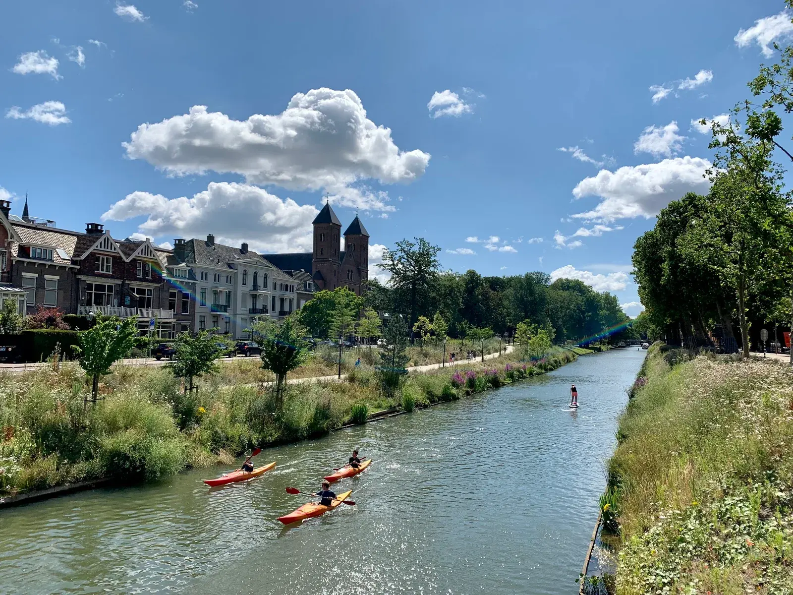
On 12 September 2020, the restored Catharijnesingel opened. Boats could once again travel around the old city centre, and the singel formed a continuous ring for the first time since the partial filling.
The present-day water does not return Utrecht to the Middle Ages. Its banks, bridges and neighbouring buildings belong to a contemporary city. The station area still serves trains, buses, bicycles, pedestrians, shops, homes and cars. Restoration did not erase modern Utrecht; it changed which piece of its history the city chose to build upon.
That is why the Catharijnesingel matters beyond the novelty of a road becoming a canal. The same urban boundary has served defence, shipping, leisure, traffic and public space. Its latest transformation shows that infrastructure is not permanent simply because it is made from concrete. Cities inherit earlier decisions, but they can decide to reinterpret them again.
Evidence and sources (2)
- Visie stadswater Utrecht
Documents the 2020 opening and the return of a continuous navigable ring around the historic centre.
Gemeente Utrecht · Accessed - Een singel rondom
Documents the 2020 opening and the return of a continuous navigable ring around the historic centre.
Gemeente Utrecht — Erfgoed Utrecht · Accessed
- Visie stadswater Utrecht
Sources
- De Utrechtse stadsverdedigingGemeente Utrecht — Erfgoed Utrecht
- Een singel rondomGemeente Utrecht — Erfgoed Utrecht
- CatharijnesingelGemeente Utrecht — Erfgoed Utrecht
- De Amsterdamsestraatweg in Utrecht: Van belangrijke winkelstraat tot afvalputjeOud-Utrecht
- Project Stationsgebied: Informatievoorziening aan de gemeenteraad van UtrechtRekenkamer Utrecht
- Bergstraat — Basisrapportage Archeologie 71Gemeente Utrecht
- Referendum stationsgebied Utrecht, 2002 — evaluation appendixTilburg University
- Visie stadswater UtrechtGemeente Utrecht